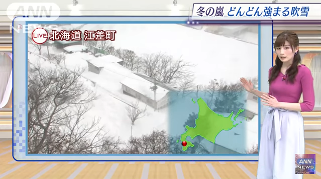
Reports taken from Hokkaido Esashi-cho, a town on the Japan Sea side near Hakodate of Hokkaido. Gusts of around 30 meters have been observed there. There is a windstorm snow warning in Northern Japan, and it has become a storm in winter considerably wide.
Wind may cause blackouts due to fallen tree
Looking at the weather chart at 9 o’clock this evening, the low pressure will rapidly develop and the interval between the isobars will become considerably narrower. Low pressure is at the bottom of the valley. The narrower the isobar is, the steeper the slope becomes. As the wind hits a steep slope, it will have a momentum. Northern Japan is in this state right now.
The maximum instantaneous wind speed is expected tomorrow tomorrow, 40 meters is predicted mainly in the southern part of Hokkaido. The forecast of 40 meters is the strongest wind this year. This wind may cause blackouts due to fallen trees, traffic disruption, etc. As this snow adds to this wind, there is a fear of whiteout that the outlook is not totally at all.
See the snow area of tomorrow with the weather mark. Not only in the Sea of Japan side of Hokkaido, but also in Abashiri and Kushiro, it seems to be a blizzard. The snow peak seems to be until the morning. There will not be any collapse in the rest of the rest.
Especially the temperature does not rise in northern Japan and Hokuriku. Sendai also gets up to 3 degrees only, and the wind is strong so please go out with measures against cold weather.
Next Tuesday, it is a snow mark in Tokyo. For now it is snowing from the early Tuesday to the morning of Tuesday. The Sea of Japan side seems to be in a state where it is likely to snow more easily.
https://www.youtube.com/watch?v=YZkPznIUfKQ
Source: Ann News


