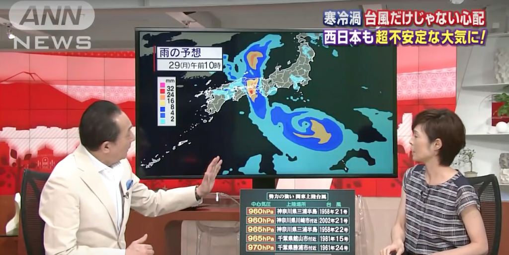
Typhoon No. 10 may become “very strong” and proceed along an unusual course to land on Honshu as early as Tuesday, according to the Japan Meteorological Agency.
As of Friday, the typhoon was traveling east on the south side of Minami-Daitojima island in Okinawa Prefecture and was forecast to become “violent,” the highest level on the agency’s intensity scale, on Sunday. The agency has issued an alert.
Typhoon No. 10 formed to the east of Tokyo’s Hachijojima island on Aug. 19, according to the agency. It is said to be rare for a typhoon to emerge near Japan. The latest typhoon is forecast to travel southwest over the sea located south of Japan and come back like a boomerang.
As of 9 a.m. Friday, the atmospheric pressure at the center of the typhoon was 945 hectopascals with a maximum wind speed of 45 meters per second. This was much stronger than Typhoon No. 9 and Typhoon No. 11, which recently made landfall in Japan.
Typhoon No. 10’s “very unique movement,” as described by a spokesperson for the agency’s Forecast Department, was due to high pressures from east and west battling with each other over Japan, on top of relatively higher sea temperatures than usual.
Typhoon No. 10 originally was advancing southward as if pulled by high atmospheric pressure located to the west. However, it temporarily stopped over the waters near Minami-Daitojima. While there, the typhoon grew large.
https://www.youtube.com/watch?v=mz2lUjxSeqM
The warmer the sea temperature, the larger a typhoon will grow. Due to the El Nino phenomenon, which wound down in spring, the sea temperatures where Typhoon No. 10 temporarily stopped were about 1 C to 2 C higher than in other years.
On top of that, high pressure located east of Japan began stretching southwest as if approaching the typhoon and pushed Typhoon No. 10 to the northeast. After storing up energy, the typhoon changed course and is expected to travel north as if tracing the edge of the high pressure area.
The typhoon is expected to become “violent” on the intensity scale and then wane somewhat to become “very strong” by the time it approaches Honshu on Monday. A typhoon on this level has not made landfall in the Kanto region in the last 30 years.
Even so, the forecast may change depending on how high-pressure areas move.
“Strong wind and high waves are expected in areas near the typhoon’s landfall. Be aware of the latest forecasts and prepare for the storm,” the agency official said.
Source: The Japan News


