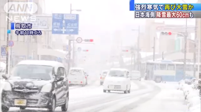
Snow is beginning to fall on the Sea side of Japan from 11th morning due to the influence of intense cold air flowing in the vicinity of Japan. There is a danger of heavy snow again in a wide area from now on, and vigilance is necessary for traffic disorder etc.
Strong cold air is gradually flowing in from west Japan, and it is snowing in Tottori prefecture and Shimane prefecture in the morning. After this, the area of snow spreads on the side of the Sea of Japan, and the other day, there is a fear that heavy snow will occur around the Hokuriku that was a record heavy snow. The expected amount of snowfall over the morning of 12th is maximum 60 centimeters in Hokuriku, 50 centimeters in northeast, etc. There is a danger that the amount of snow may increase even after 12th. Please beware of traffic disorder caused by heavy snowfall. On the other hand, the temperature is rising due to the sunlight in the Kanto region. The highest temperature until 11:00 am on November 11 is over 15 degrees at Katsuura such as Chiba Prefecture, and it is also 12.2 degrees in Tokyo center. Temperatures will rise even further in the afternoon, 15 degrees in Yokohama and Kumagaya, 13 degrees in Tokyo’s central city, it is predicted that it will be warm in March.
Source: ANN News


