
https://www.youtube.com/watch?v=IbBaP6xaLh4
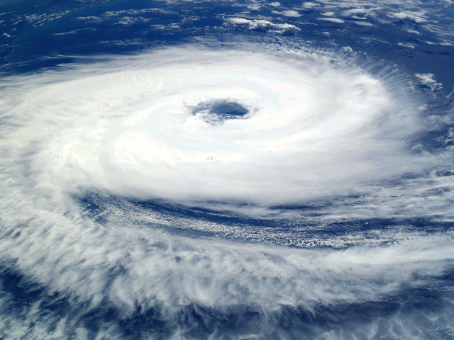
Powerful Typhoon No. 10 is expected to be the first typhoon in at least 65 years to make landfall in the Tohoku region from the Pacific Ocean side on the evening of Aug. 30.
The Japan Meteorological Agency is warning that heavy rains of 80 millimeters or more per hour are expected to fall in some parts of northern Japan, including Tohoku.
The agency is also advising commuters in the Kanto region to take precautions against strong winds and heavy rain on the morning of Aug. 30.
As of noon on Aug. 29, Typhoon No. 10 was advancing in the waters about 340 kilometers southeast of Hachijojima island at a speed of 25 kph. The atmospheric pressure at the center of the typhoon was 945 hectopascals. The maximum wind speed near the center was 162 kph. The maximum momentary wind speed was 216 kph.
Typhoon No. 10 is expected to reach waters about 360 km southeast of Choshi, Chiba Prefecture, in the morning on Aug. 30, although it is expected to slightly weaken by that time.
The typhoon is forecast to make landfall on the Tohoku region later that day and move to the Sea of Japan before dawn on Aug. 31, the agency said.
According to the agency, no typhoons have landed on the Tohoku region from the Pacific Ocean side since statistics became available in 1951.
In the period from Aug. 29 to Aug. 30, the maximum wind speed is expected to be 126 kph in the Tohoku region and 82.8 kph in the Hokkaido and Kanto regions.
The amount of rainfall during the 24-hour period until the morning of Aug. 30 is predicted to be up to 200 mm in the Tohoku and Kanto regions and Yamanashi and Nagano prefectures.
Source: The Asahi Shimbun
